About Marine Chart Symbols
Complete reference for symbols, abbreviations and terms used in marine charts. Useful as an aid for teaching and learning, or as reminder for experienced sailors and sea cartography users. INCLUDES - Comprehensive...
Complete reference for symbols, abbreviations and terms used in marine charts. Useful as an aid for teaching and learning, or as reminder for experienced sailors and sea cartography users.
INCLUDES
- Comprehensive coverage: more than 800 symbols and abbreviations.
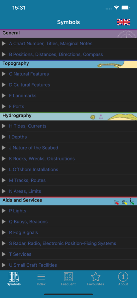
- Full content tree, organised for ease of use.
- Index and grouped index for all entries.
- Search facility.
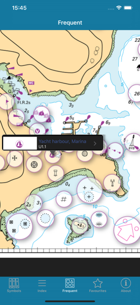
- Sample chart with visual popups for commonly used symbols.
- Favourites: archive your best symbols.
- Multi-language within the app (English/French).
Full international standard from the IHO.All topics from the IHO, UKHO, SHOM, NOAA, CHS and other hydrographic offices:
position, distance, direction, compass, features, landmarks, ports, tides, currents, seabed, rocks, wrecks, obstructions, offshore, tracks, routes, areas, limits, lights, buoys, beacons, fog, radar, radio, services, small craft.
LANGUAGES
English, French, German, Italian, Spanish
ABOUT US
Imray are a leading chart and marine book publishers, based in England and with a catalogue of charts for Europe, the Mediterranean and the Caribbean. Imray's pilot books cover the whole world in extensive detail.
In partnership with Imray, software developers and sailors.
Follow us on Twitter - http://twitter.com/imray_charts
Facebook - imraynautical
Look out for other applications in the Marine Navigation Series from Imray:
TIDES PLANNER - tide predictions any date
RULES & SIGNALS- Rule of the Road, signals at sea.
RACING RULES - RYA Handy Guide to rules for sailing races
Oct 7, 2019
Version 2.1.0
• iOS13 compatibility including dark mode.
Previous Versions
Here you can find the changelog of Marine Chart Symbols since it was posted on our website on 2016-10-30 21:10:56.
The latest version is 2.1.0 and it was updated on 2024-04-22 09:40:45. See below the changes in each version.
Marine Chart Symbols version 2.1.0
Updated At: 2019-10-07
Changes: Oct 7, 2019 Version 2.1.0
• iOS13 compatibility including dark mode.
Marine Chart Symbols version 1.4
Updated At: 2011-08-21
Marine Chart Symbols version 2.1.0
Updated At: 1970-01-01
Changes: 2019年10月7日 Version 2.1.0
• iOS13 compatibility including dark mode.
Marine Chart Symbols version 2.1.0
Updated At: 1970-01-01
Changes: 7 okt. 2019 Version 2.1.0
• iOS13 compatibility including dark mode.
Disclaimer
Official App Store Link
We do not host Marine Chart Symbols on our servers. We did not scan it for viruses, adware, spyware or other type of malware. This app is hosted by Apple and passed their terms and conditions to be listed there. We recommend caution when installing it.
The App Store link for Marine Chart Symbols is provided to you by apps112.com without any warranties, representations or guarantees of any kind, so access it at your own risk.
If you have questions regarding this particular app contact the publisher directly. For questions about the functionalities of apps112.com contact us.